Where does the Pacuare River start and end?
The headwaters of the Pacuare River are found in the Cordillera de Talamanca, which is the tallest mountain range in Costa Rica, with the highest peak reaching 3,820 meters (12,530 feet). The river then flows approximately north until the town of Siquirres, at which point it then meanders east, eventually ending at the Caribbean Ocean, just north of the town of Limon.
How long is the Pacuare River?
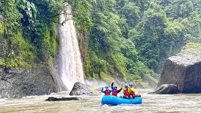
The Pacuare River is 133 kilometers long. The portion that we raft on is 26 kilometers long and is known as the Lower Pacuare.
What does Pacuare mean?
The word Pacuare means baby Macaw, but it is not a Spanish word. It comes from the local indigenous Cabecar in the Pacuare River area.
How do you pronounce Pacuare?
Pacuare is pronounced Pa-Kwa-Ray
What’s the water temperature?
The Pacuare has warm, comfortable water, typically 21C and higher. (70F and higher.) You won’t need a wetsuit or splash jacket for our rafting trips. For more water temp information, visit this blogpost.
What kind of rapids are on the Pacuare?
There are Class II, III, and IV rapids. Class IV rapids are beginner-friendly but on the exciting side.
Who made the first descent?
The first descent of the Pacuare River was accomplished in 1980 by a group of kayakers from Poland. Their adventures were made into a documentary called Godspeed, Los Palocos!
Does the Pacuare River have a hiking trail?
While there isn’t a trail that follows the river, we do have trails at both our Pacuare Eco-Lodge and Rio Vista Lodge that lead you up Linda Creek, which is a small tributary to the Pacuare.